
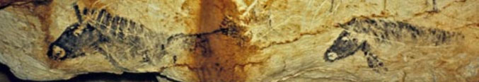
(1) The Farne Islands are a group of islands off the
coast of Northumberland, England.
There are between 15 and 20 or more islands depending on the state of the tide.
The main islands in the Inner Group are Inner Farne, Knoxes Reef and the East
and West Wideopens (all joined together on very low tides) and (somewhat
separated) the Megstone; the main islands in the Outer Group are Staple Island,
the Brownsman, North and South Wamses, Big Harcar and the Longstone. The two
groups are separated by Staple Sound. The highest point, on Inner Farne, is 19
metres (62 feet) above mean sea level. |
 |
| (Google Image I:A) Location map of the Farne Islands, Northumberland |
 |
| (Fig. I:B) Grid type pattern carved into it (to a depth of 1-2mm, Farne Islands, Northumberland (Photography by: Ben Burville) |
Tagus valley, Portugal:
Portugal’s most important rock art finds of the last three decades, have a rather unfortunate association with dam projects like: Fratel dam on the river Tagus, Pocinho dam on the river Douro, river Coa dam, Laranjeira dam on the river Sabor, Alqueva dam on the river Guadiana. Some got lost in this project but some were preserved after a long struggle by the culture preservers, the local agencies, college professors and also societies.
Cosquer Cave, France:
Famous rock art site in the world, I wants to say here that from this discovery a new concept develop in my mind that we have to think in this way also which I have already describe above. This is till now biggest and only one site where the evidence of Pictograph, Petro glyphs and Pictograph-cum-Petro glyphs has been noticed. (This new term I have introduce before you already, Pictographs-cum-Petro glyphs means all those rock art, in which after petro glyph, pictographs has been done, in the removed rock surface. Such a type of art we have noticed in Orissan rock art and Hazaribagh region of rock art in Indian context.) In July 1991 Dr.Jean Clottes, an English teacher (Honorary President of the French Prehistoric Society, Scientific Advisor for Prehistoric Art, Director of Prehistoric Antiquities) and a deep sea diver Henri Cosquer discovered paintings and engravings in a cave beneath the sea near Marseilles (France) on the Mediterranean (Google Image II:C). The gallery slopes up for about 360 feet under water before reaching a huge chamber that partly remained above the sea where many prehistoric paintings and engravings are preserved on the walls (Drawing V) as well as remains on the ground (charcoal, a few flint tools). This is the only painted cave in the world with an entrance below present-day sea level where cave art has been preserved from the flooding that occurred when the seas rose after the end of the last glaciations. Between 1991 and 2002 a number of dives were organized with the participation of Dr. Jean Courtin, who is professional archaeologist cum diver and Dr.Jean Clottes. The extraordinary location of the cave entrance is due to the rise of the sea level after the end of the last glaciations and the melting of the thick ice caps. The walls of all the passages and chambers under the water have been corroded and no painting or engraving has been preserved. The rock art discovered is located in the upper chambers that have remained above the sea. About 180 animal figures have been registered, as well as many dozens of diverse geometric signs, 1000 finger drawings, 65 hand stencils and a strange image of a ‘killed’ man has been noticed.
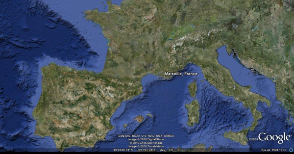 |
(Google Image II:C). Location of the Cosquer Cave, Marseilles,France. |
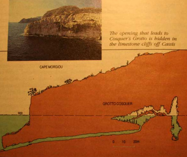 |
| (Drawing V) A huge chamber that partly remained above the sea, Cosquer Cave, Marseilles, France |
Most of the rock art in Europe except for Gargas (Hautes-Pyrénées) and
possibly El Castillo in Spain were located in the eastern side of the chamber,
with one in the south and none in the west. Right at the brink of a
57 feet deep vertical shaft a location which in itself is significant,
there are paintings in black. On other panels they may be in black or red. One
positive red hand has been found. A number of adult hand stencils have been
scratched or painted over with dots and bars. (Figure VI) Many of them
have incomplete fingers produced by bending of the fingers. Hand stencils with
incomplete fingers had until very recently only been found in very few caves,
mostly in the Pyrenees (Gargas, Tibiran, Fuente del Trucho). The Cosquer Cave, even though most of its art was no doubt destroyed when it got flooded,
is however a major discovery because it is in the Provence where no such site
had been known before with such a abundant animal figure, hand stencils.
However sea animals rarely or never depicted (seals, auks). The ground is littered with charcoal which could be the
remains of the wood which people burnt in order to get the black color for
making drawings. People did not live in the depths of those caves.
 |
| (Fig. VI) Adult hand stencils, Cosquer Cave, Marseilles,France, (Photography by: J. Clottes) |
Date: A total of 24
C14 dates have been obtained. They suggest that the cave had been
frequented during two periods, first around 27,000 before present, then around
19,000 BP. The evidence tells us that ancient people went into the
Cosquer cave during at least two different periods. During Palaeolithic times,
the sea level was about 360 feet lower than it is now, and the coast was 3
miles away from the cliff. When the sea rose dramatically [about 12,000 years
ago] more than half the cave was flooded. What was called Phase 1 is now well
dated at about 27,000 years ago by four radiocarbon analyses. Following Phase
1, the cave was abandoned for about 8,000 years, unless people used it without
leaving any evidence of their presence. It is believe by scholars that it was
during Phase 2 all the animal paintings and other engravings were made. This
period is well dated at about 18,500 to 19,000 years ago by means of radiocarbon
analysis of the charcoal used in some of the paintings, as well as by some
charcoal lumps found on the floor.
Nature of Paintings: Only Rock painting and engraving has
been noticed from this place. Animals like Aurochs, saiga, mega ceros, deer and marine animals (Penguins and seals) are depicted. The explorer has noticed the presence of composite animal figures viz. horse head with bison horn. This
unrealistic representation evokes a mythological scheme. According
to J. Clottes, a mixed representation of human and a seal with spear piercing
it was also noticed.
Horses are the most
numerous, making up nearly one-third of the total. In some drawings they are represented by its head alone; in
others, with the whole body. Such minute details as the difference
in coat colour between belly and flank are discernible in one painting. On the
same panel are three black horses with an ibex engraved over one of them. (Figure VII) Horses are the animals most often depicted in other Upper
Palaeolithic caves, so their dominant presence in the Cosquer cave is not
unusual. The next most commonly depicted animals are ibexes and chamois, which were the animals that favoured the rocky
environments that existed during Palaeolithic times. All but one black ibexes
are engraved. Their bodies are accurately proportioned, except for the horns. Several
European bison have also been
portrayed. (Clottes J. & Courtin J., 1993:9)
 |
| (Fig. VII) Black horses with an ibex engraved over one of them, Cosquer Cave, Marseilles,France, (Photography by: J. Clottes) |
The lower part of
Cosquer Cave, partly submerged, remind us that the Palaeolothic man is directly associated with the important change of the
seashore position, which took place from last glacial maximum to present time.
Cosquer cave is not the single cave on this area. Triperirie and Figuier caves were known for a long time to the divers from Marseille and Cassis. In
the upper part of the cave, rock art is well preserved, but the lowest series
are submerged. The cave entrance, which is 37 m. below the sea level, was
closed by the sea between 8000-6000 B.P. (J.Collina, 1996:
27-40).
The World
Heritage Rock Art in Alta is a rich cultural monument consisting of several
carvings and paintings localized in the inner parts of the Altafjord in
Finnmark, Norway (2). (Google Image VIII) Interestingly
all painting and engravings were about 2 c.m. to 2 m. distance from seashore.
The rock art in Alta was made over a long period of time, from 4200B.C. to 200
A.D. Within this period we can see both continuity and change. After few years
it may get submerged into the sea.
(2) Situated at the northernmost part of continental Europe, where Norway swings eastward, Finnmark has always been an area where east meets west, in culture as well as in nature and geography. Vardo, the easternmost municipality in the country, is located farther east than St. Petersburg and Istanbul. |
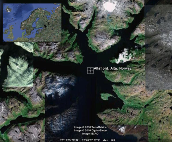 |
| (Google Image VIII) Altafjord in Finnmark, Norway (In inset Norwey Country) |
Defining
the history of Pre-European settlement in the Pacific has been a subject of scholarly
concern since Captain James Cook sailed these oceans in the eighteenth century.
Archaeological research of the last 50 years provides a fairly clear picture of
the successive stages of human expansion in this region, which forms a quarter
of the world’s surface. The western Pacific lands, comprising Australia, New
Guinea (3) and its eastern archipelagos, got settled during the
Pleistocene, probably over 40.000 year ago. (Kirch, P.V. 2000)
(3) Papua New Guinea, officially the Independent State of Papua New Guinea,
is a country in Oceania,
occupying the eastern half of the island of New Guinea and numerous offshore islands (the western portion of the island is a part of
the Indonesian provinces of Papua and West Papua). It is located in the
southwestern Pacific Ocean. These ancient inhabitants
probably had their origins in Southeast
Asia, themselves originating in Africa 50,000 to
70,000 years ago. New Guinea was one of the first landmasses after Africa and
Eurasia to be populated by modern humans, with the first
migration at approximately the same time as that of Australia. |
Island Melanesia
Recently
most archaeological research program in Island Melanesia (4) had
been concerned with first settlement sites having rock art. About 3000
engravings had been noticed on the sea shore and some are now submerged in the
sea. (Figure IX) (Christophe Sand 2009:255)
(4) Melanesia is a sub region of Oceania extending from the western end of the Pacific Ocean to the Arafura Sea and eastward to Fiji.
The region comprises most of the islands immediately north and northeast of Australia. |
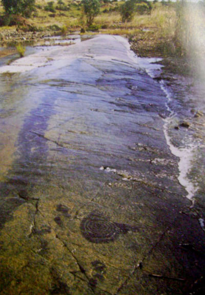 |
(Fig. IX) Engraving in circles on the bed rock near sea shore of Island Melanesia, (Photography by: Christophe Sand) |
Rock art represents an irreplaceable cultural heritage. The government is not only necessarily its most ardent protector. Independent, preferably international peer review is essential. Perhaps it could be argued that international rock art scholars should not concern themselves with their region alone. The rock art is not the property of any state or private. It is the property of all humanity. It is to be treated as such, and not as a hostage of an inexperienced, secretive and deceptive technocracy.
The entire art site is a sacred monument. As a fact of history, it is inseparable from the human race. In this context rock art reflect the relationship between people and the land. The pre-historic rock painting reflects the Mesolithic and Chalcolithic cultural traits. Most of the Mesolithic paintings are expressions of relationship between human beings and animal life. The depiction of paintings shows lifestyle of hunting and gathering society particularly of the Mesolithic age. The Mesolithic people have tried to explain the day to day activity of their society. They have given expression to the challenges they have faced in life through the paintings. Sometimes the Mesolithic paintings were executed in very inconvenient places like high rock walls or ceiling and it could only have been done using ladders and scaffolding. Occasionally the Chalcolithic paintings are executed overlapping the early paintings.
The first
step in protecting the prehistoric rock art is proper identification and safeguarding
it. Underwater Rock art remains in little known areas have to be explored and
to their names have to be recorded on a map so as to give a better idea of
geographical extent and the dangers they may face. For the purpose of future
referencing, it is absolutely essential to compile a detailed and illustrated
inventory of underwater rock art in accordance with the location and state of
preservation of the sites. Such a work should include all the known sites and
particulars of their art and archaeological contents. Drawings of the paintings
should be prepared. In India there are already legislations for the protection
of cultural heritage sites but they need some change or modifications and should
be implemented strictly. Bodies
like the Archaeological Survey of India (A.S.I.) and Department of
Anthropology, Government of India, should serve as the nodal agencies in such a
project. Universities and State Department of Archaeology, Rock Art Society of
India, I.G.N.C.A., I.F.R.A.O. and other qualified Institutions could also be
assigned a specific area comprising rock art sites for the purpose of documentation.
The work can also be undertaken as a project under the University Grants
Commission (U.G.C.) or the Indian Council of Historical Research (I.C.H.R.). If
possible UNESCO could also be approached for the purpose. It is time to realize
and meet our responsibility for preservation and further study of rock art as
it being an important part of our proud cultural heritage. We should at least
endeavor to make and have records of this art and culture for the edification
and betterment of the future generation.
I sincerely like to Dr. D. N. Sinha, (Dy. S.A., A.S.I.), S. Krishnamurthy (Assistant Epigraphist, Lucknow),
Dr. Robert G. Bedenarik (Convener of IFRAO) and Shri Amitabh Tiwari who inspired us to focus ourselves in archaeological research and spared their invaluable time to offer me the most needed suggestions and for guidance in the preparation of this paper. I also thank to all the authors of many publications and scholars, whose support and guide, helped me to write this article.
![]()
—¿Preguntas, comentarios? escriba a: rupestreweb@yahoogroups.com—
Cómo citar este artículo:
Tiwary, Sachin Kr. Underwater rock art: in global context.
En Rupestreweb, http://www.rupestreweb.info/underwaterockart.html
2014
Referencias
Argyll, Royal Commission Ancient & Historical
Monuments, Scotland, volume 6, HMSO 1988, pp.160-61.
Christophe Sand, ‘Ocean Rock art: First direct dating of prehistoric stencils and
paintings from New Caledonia (Southern Melanesia)’ in Martine Carver ed.,
Antiquity; Volume 80, No. 309, 2009 September, p. 255.
Clegg, J., Comment of D. Groenfeldt’s “The Interpretation of Prehistoric Art”
in Rock art Research, Volume 2 (I) 1885, p.p.89-90.
Collina J.Girard, Prehistory and costal karst area: Cosquer Cave and the Calanqes of Marseile, Speleogenesis and Evolution of Karst Aquifers, Karstologia, 1996,p.p. 27-40.”
in Rock art Research, Volume 2 (I) 1885, p.p.89-90.
Jean Clottes and Jean Courtin, 1993 April, Neptune’s Ice
age Gallery,” By, Natural History, p. 9.
Mucklroy, K., Maritime Archaeology. New York: Cambridge
University Press, 1978, p.34.